Bukid Ayakan is a hill in Barangay Constancia, San Lorenzo, Guimaras that stands 217 meters above sea level. It spans 57.65 hectares and features diverse vegetation, layered rock formations, and a notable cave-like structure known as trangkalan. Its coconut palms and rice fields which have been a source of livelihood to the locals. Historically, it served as a refuge and fortress for residents during World War II. Culturally, it is believed to be home to supernatural beings, and, during Holy Week, is visited by faith healers for rituals. From its summit, visitors can view the neighboring seas and mountains on a clear day, including Mt. Kanlaon. Despite being privately owned, the hill is under the stewardship of the community and barangay, spearheading efforts to conserve its natural and cultural heritage.
Location/s:
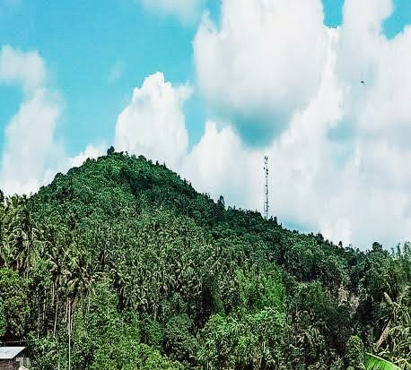
Photo Credit/s:
San Lorenzo Tourism Office, 2024
Mappers:
April Rose C. Saludes (2021), Gilly Jay H. Talaban (2024), Alpha Queen Tayona (2024), Hannah Mañero (2024), Amy Ross Gamarcha (2024)
Tags:
217 Meters Above Sea Level, 57.65 Hectares, , , Bukid Ayakan, Coconut Farming, Community Stewardship, Cultural Heritage Conservation, Diverse Vegetation, Faith Healers, Folklore, Highest Point, Holy Week Rituals, Layered Rock Formations, Livelihood Source, Mt. Kanlaon View, Natural Heritage Conservation, Neighboring Seas, Private Property, San Lorenzo Guimaras, Summit View, Supernatural Beings, Trangkalan Cave, Vegetable Farming, World War II Refuge
Want to know more?
Inquire about this specific heritage by filling up the form below.
We will get back to you with an answer as soon as we can.